Do you want to step outside your front door and be on a lake loop or a creekside trail within minutes? If open space and daily outdoor time are high on your wish list in Lafayette, you are not alone. You want clarity on which parts of town actually deliver that easy access, and what trade-offs to expect. In this guide, you will learn how Lafayette’s parks, trails, and county open space shape daily life, which areas offer the best access patterns, and the key checks to make before you buy. Let’s dive in.
How open space shapes daily life in Lafayette
Living near a lake, creek trail, or county parcel changes your routine. You shorten dog walks and dinner-hour strolls, and you can bike for errands or weekend outings without loading the car. Families often find it easier to reach playgrounds and fields, and active commuters can use paved paths for low-stress rides.
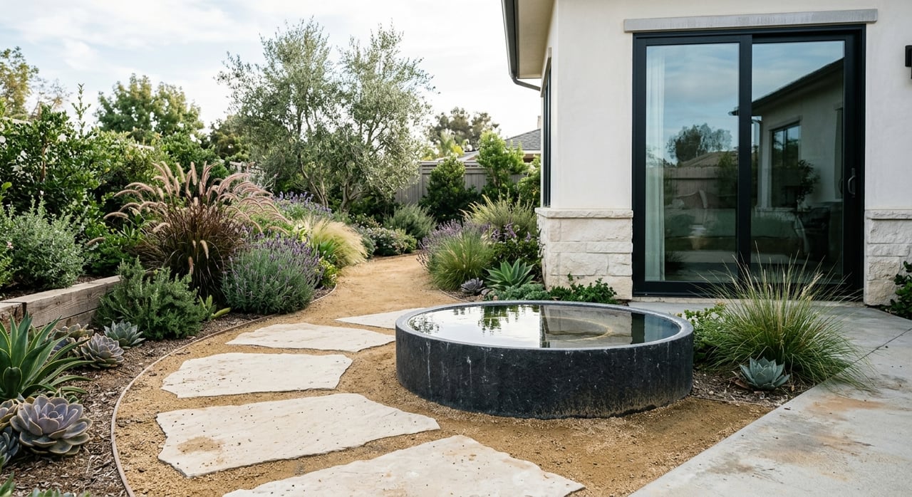
It also helps to know the difference between urban green space and natural open space. City parks like Waneka Lake Park feel manicured and social with paths, picnic spots, and events. County-managed parcels at the city’s edge feel more rustic with unpaved trails and wildlife viewing.
The open-space assets that matter
- Waneka Lake and Waneka Lake Park: A central, walkable lake with a loop path, picnic areas, and frequent community programming near downtown. You get a town-center feel with water views and short walks to restaurants and shops.
- Coal Creek Trail: A multi-use regional trail that runs through Lafayette, linking neighborhoods and offering off-road bike and pedestrian access toward nearby communities. It is popular for family rides and active commutes.
- City parks and neighborhood greenways: A network of playgrounds, fields, and courts ties many subdivisions together. Many parks include trail spurs that connect to larger routes.
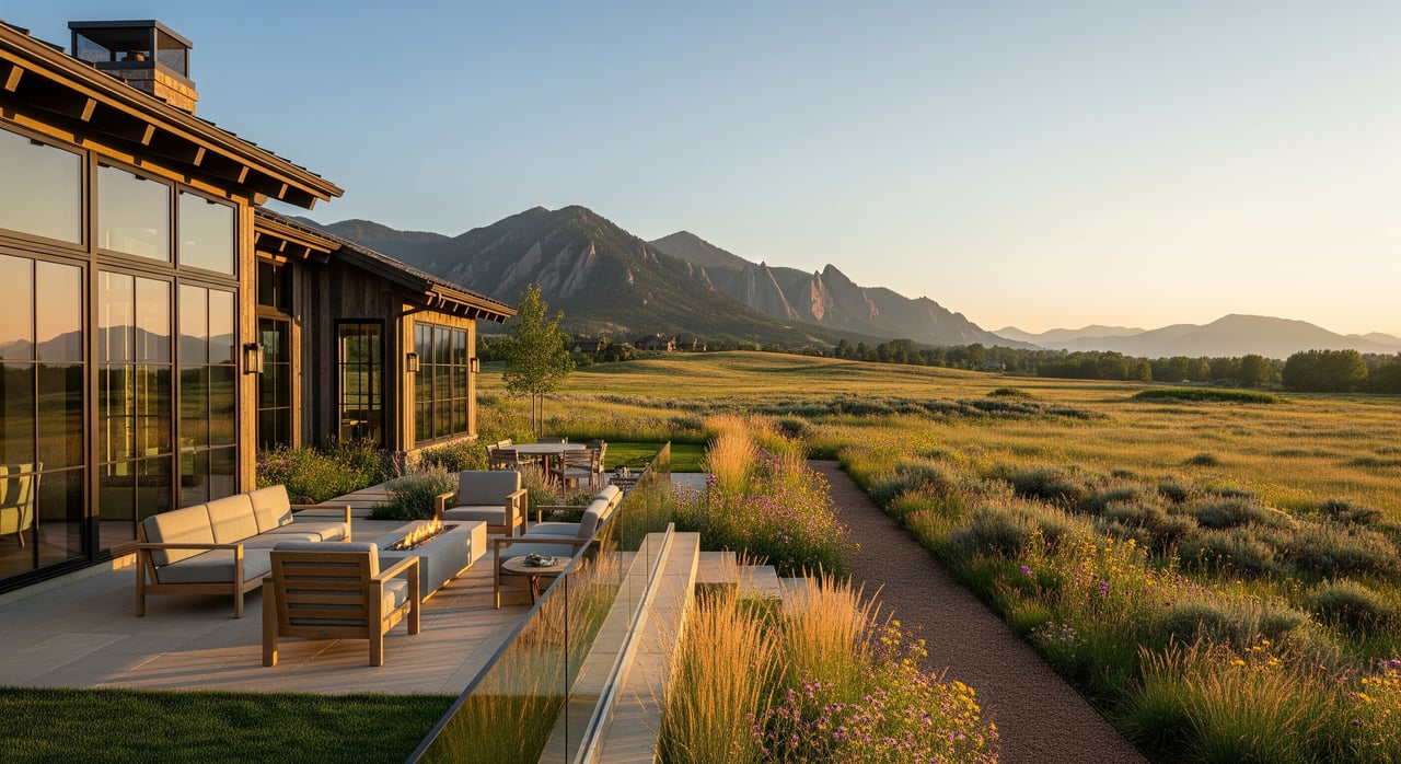
- County open space at the edges: On Lafayette’s outskirts, Boulder County parcels provide a more natural experience with unpaved trails and wildlife. These spots appeal if you want a semi-rural hike close to home.
- Regional connectivity: Lafayette sits inside a larger Front Range trail network. That connectivity can make a big difference if you plan longer rides or cross-town bike commutes.
Best areas for open-space access
Downtown and Waneka Lake area
- Access pattern: Walk-out access to Waneka Lake Park and downtown shops with short trail segments. This is ideal if you want daily waterfront walks and a true neighborhood feel.
- Housing snapshot: Historic bungalows, older single-family homes on smaller lots, and a few townhomes or condos near the core.
- Day-to-day life: Grab coffee on foot, loop the lake after work, and enjoy frequent community events. Local errands often do not require a car.
- Trade-offs: Smaller yards and less privacy. Parking can be tight during events.
Creek-side and Coal Creek Trail corridor
- Access pattern: Direct or near-direct connections to Coal Creek Trail and multi-use paths. Strong choice for routine bike rides and low-stress commuting.
- Housing snapshot: A mix of mid-century single-family homes and newer infill townhomes, plus subdivisions that open directly to the trail.
- Day-to-day life: Kids bike to parks or school, and you can log workouts on a paved path year-round. Expect more walkers and riders near trailheads.
- Trade-offs: Some properties may be in or near a floodplain. Trailheads can bring through-traffic and occasional noise.
Northern and edge neighborhoods near county open space
- Access pattern: Short drives or quick trail links to county open-space parcels and unpaved trailheads. Great for weekend hiking and wildlife viewing.
- Housing snapshot: Newer subdivisions with contemporary single-family homes and townhome clusters, sometimes on larger lots.
- Day-to-day life: Quiet streets, trailhead meet-ups, and a little more separation from downtown bustle.
- Trade-offs: Slightly longer trips for errands and dining. You may rely more on a car for quick stops.
South and southwest neighborhoods near community parks
- Access pattern: Close to community parks, sports fields, and neighborhood greenways. Ideal for organized sports and easy playground time.
- Housing snapshot: Family-oriented subdivisions with yards, cul-de-sacs, and on-site play areas.
- Day-to-day life: Weekend games, neighborhood gatherings, and consistent access to fields and courts.
- Trade-offs: Less immediate access to more natural trailheads. These areas are park-forward rather than wilderness-forward.
A day in the life, by area
- Downtown and lake loop: Morning coffee on foot, a lunchtime lap around Waneka Lake, and a quick evening stroll to catch a sunset by the water.
- Creek-side corridor: School drop-off by bike along the path, a midday run on the trail, and a relaxed family ride after dinner.
- Edge near county open space: Early morning birdwatching on dirt trails, a short drive for a weekend hike, and quiet evenings with wide skies.
- South and southwest parks: Saturday games at community fields, a picnic under shade trees, and easy dog walks on neighborhood greenways.
Due-diligence checklist for open-space buyers
Use this list when you tour homes and review disclosures. A few extra checks now can save you time and stress later.
- Floodplain and creek setbacks: If a property sits near Coal Creek or a drainage corridor, review floodplain maps and request elevation and historical-flooding information during escrow.
- Trail easements and maintenance: Confirm whether adjacent paths are publicly maintained or private/HOA-owned, and ask about any access limitations.
- HOA rules and outdoor use: Review policies on fencing, landscaping, exterior storage, and trail-adjacent areas. This matters if you have bikes, pets, or gear.
- Parking and event impacts: For homes near park hubs or lake venues, check event calendars and observe weekend traffic patterns.
- Seasonal conditions: Ask about seasonal closures, algae blooms at lakes, spring mud on dirt trails, and typical maintenance schedules.
- Wildlife and privacy: Expect wildlife sightings near open space. Evaluate sightlines from paths and how you will manage privacy.
- Bike-commute feasibility: Test your route for distance, surface type, and lighting if you plan to ride at dawn or dusk. Confirm secure bike storage.
- School access to parks and trails: If you have school-age children, review district boundaries and walking or biking routes, including whether crossings use underpasses.
Trade-offs to weigh
- Lot size vs. access: Downtown and lakeside homes often trade larger yards for immediate access. Edge areas may offer more space with a short drive to trailheads.
- Park vibe vs. natural feel: Decide if you prefer manicured parks with social energy or more rustic county parcels with unpaved paths.
- Errands vs. wilderness: Central locations keep errands short. Edge locations may offer a more natural setting with longer trips to shops and dining.
How to choose your best-fit area
- List your top three daily uses: dog walks, kid play, workouts, or bike commute. Rank them by importance.
- Match uses to access patterns: Urban lake loop, paved multi-use trail, or unpaved county parcel.
- Test the lifestyle: Visit at peak times. Walk the path, time the ride, and park at a trailhead on a sunny Saturday.
- Review the fine print: Confirm floodplain status, HOA rules, and trail ownership. Ask about seasonal conditions and maintenance.
Touring checklist for open-space seekers
- Walk the nearest park or trail entrance from the front door.
- Drive to the closest county open space and time the trip.
- Ride your planned bike-commute route at the time you expect to use it.
- Check for floodplain designations and any past mitigation work.
- Confirm whether paths by the home are public or private.
- Review HOA documents for fencing, landscaping, and storage.
- Visit during a weekend event if the home is near Waneka Lake or a major park.
- Assess nighttime lighting and sightlines on paths you will use.
Local resources to consult
- City of Lafayette Parks, Trails, and Recreation for park inventories, maps, events, and maintenance contacts.
- Boulder County Parks and Open Space for maps and descriptions of county parcels near the city.
- FEMA Flood Map Service Center and Boulder County floodplain resources for designations and mapping.
- City of Lafayette planning department for the Trails and Open Space Master Plan and local land-use guidance.
- Regional trail guides and local cycling or trail groups for route conditions and connectivity updates.
- County assessor and MLS data for lot details, easements, and housing inventory.
- Local school district resources for boundary confirmation and route information.
Partner with a local advisor
Choosing a Lafayette neighborhood for open-space access is about your daily life, not just your address. You deserve clear guidance on access patterns, due diligence, and long-term value. If you want a thoughtful plan for tours, testing commutes, and reviewing HOA and floodplain details, reach out to Sara & Svein Groem. Request a Home Valuation or ask for a custom neighborhood short list tailored to your routines.
FAQs
What makes the Waneka Lake area attractive for daily outdoor time?
- You can walk to a lake loop, picnic areas, and downtown shops, which makes short, frequent outings easy and reduces car trips for local errands.
How does the Coal Creek Trail corridor support bike commuting?
- The multi-use, largely paved trail links neighborhoods and connects toward nearby towns, which helps riders plan lower-stress routes for regular commutes.
Are creek-adjacent homes in a floodplain in Lafayette?
- Some are, and some are not; buyers should review FEMA and county floodplain maps and request elevation and historical-flooding information during escrow.
What should I check with an HOA near open space?
- Review rules for fencing, landscaping, exterior storage, pet policies, and any trail or open-space boundary restrictions that could affect daily use.
What trade-offs come with living next to a park or trailhead?
- You gain instant access and a social vibe, but you may experience more foot and bike traffic, occasional event parking, and less privacy.
Which resources offer the most reliable trail and park information in Lafayette?
- City of Lafayette Parks and Trails, Boulder County Parks and Open Space, FEMA and county floodplain resources, and regional trail groups provide authoritative updates.